
Reality Capture & Scan-to-BIM
Turn Existing Conditions Into Reliable Digital Information.
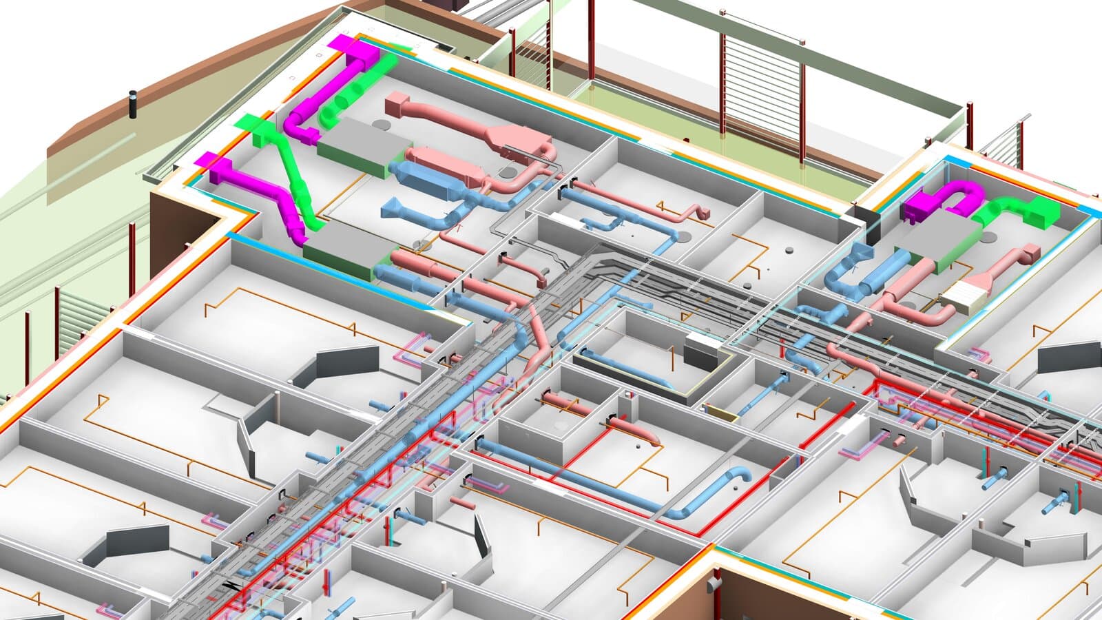
Existing buildings rarely match the drawings teams inherit. Our Scan-to-BIM workflows turn captured site conditions into structured digital information that reflects what is actually there. We use point clouds, laser scan data and site survey information to develop accurate existing-condition and as-built BIM models, giving project teams a dependable starting point when drawings are incomplete, outdated or unavailable.
We begin with the available reality-capture data, point clouds, laser scans, survey information, photographs or existing documentation, and establish the required modelling scope, LOD, accuracy and intended use.
Our teams then interpret the captured conditions and develop the required architectural, structural or MEP BIM models, validating the model against the source data throughout the process. For renovation, retrofit and complex existing facilities, this creates a reliable digital representation of the building before design or construction decisions are made.
The result is more than a converted point cloud. It is structured, usable BIM information that helps teams understand existing conditions, coordinate new designs against reality and make decisions with greater certainty.
6+
Reality Capture Inputs
3
BIM Disciplines
1
Validated Digital Representation
100–500
LOD Capability
Reality Capture Inputs
BIM & As-Built Outputs
Accuracy & Model Development
From Captured Reality to Usable BIM.
We transform point clouds, laser scan data and existing site information into accurate digital representations for design, renovation, retrofit, coordination and asset documentation. Each capability can be delivered independently or combined into a complete Scan-to-BIM workflow.
Point Cloud to BIM
- Point cloud to Revit BIM conversion
- Architectural, structural and MEP existing-condition modelling
- Geometry developed to project-specific LOD requirements
- Model elements aligned with available scan data
- BIM outputs structured for design, coordination and downstream use
Existing Conditions & As-Built BIM
- Existing-condition BIM modelling
- As-built architectural, structural and MEP models
- Building geometry and visible services captured from site data
- Existing documentation reconciliation
- Digital records for renovation, retrofit and facility planning
Laser Scan & LiDAR Data Processing
- Terrestrial laser scanning and LiDAR point cloud processing
- Point cloud registration and alignment
- Data cleaning and segmentation
- Scan data organisation for BIM production
- Integration of point clouds with existing project information
Scan-to-BIM for Renovation & Retrofit
- Existing building surveys translated into BIM
- Renovation and retrofit modelling
- New-to-existing condition coordination
- MEP and structural interface identification
- BIM support for refurbishment and adaptive-reuse projects
As-Built & Facility Documentation
- As-built BIM models from reality-capture data
- Architectural, structural and MEP documentation
- 2D drawings derived from verified BIM models
- Asset and space information where required
- Digital documentation for ongoing facility use and maintenance
Model Validation & Scan-to-Design Coordination
- BIM-to-point-cloud comparison
- Model-to-scan validation
- Existing-versus-proposed condition review
- Geometric deviation and interface checks
- Coordination of new design with existing conditions
- Validation reporting for identified discrepancies
What this covers
Point Cloud → BIM
From Captured Reality to Structured Information
Existing → Digital
As-Built & Existing-Condition Modelling
Scan → Validate
Model Accuracy Against Captured Conditions
From Captured Reality to Reliable Project Information.
Model What Actually Exists
We develop BIM models from captured site conditions, giving teams a reliable digital representation when existing drawings are incomplete or outdated.
Reduce Existing-Condition Uncertainty
Point clouds and scan data provide a stronger basis for renovation, retrofit and coordination decisions than assumptions based on legacy drawings.
Coordinate New Design With Reality
Existing-condition BIM helps teams test proposed architecture, structure and MEP against the physical environment before work reaches site.
Detail Matched to the Purpose
Models are developed to the required LOD, accuracy, project standards and intended use, rather than modelling more detail than the project needs.
Validate Against Captured Data
We use the source point cloud and reality-capture information to review model accuracy and identify discrepancies before the information moves downstream.
Information That Stays Useful
The resulting BIM and as-built information can support design, coordination, construction, facility documentation and future modifications beyond the initial project requirement.
Where Reality Capture Creates the Most Value.
Heritage & Conservation
Detailed digital documentation for historic and protected buildings where existing drawings may be incomplete and irregular geometry requires accurate capture.
Renovation & Adaptive Reuse
Existing-condition BIM that gives design teams a reliable foundation for refurbishment, redevelopment and adaptive-reuse projects.
Industrial & Process Facilities
Capture and model existing structures, equipment, pipework and services before modifications, expansions or new installations begin.
Airports & Transportation
Digital documentation of complex existing environments to support upgrades, extensions, refurbishment and infrastructure development.
Data Centres & Mission-Critical
Accurate existing-condition information for dense technical environments where equipment, MEP systems and restricted spaces leave little room for uncertainty.
Facilities & Asset Documentation
Structured digital records of existing buildings and assets to support facility planning, maintenance, future modifications and long-term information management.
Reality Capture & Scan-to-BIM FAQs.
Related capabilities.
Audited
Every engagement is delivered against certified management systems — not just claimed adherence.

Information Management
BIM delivery

Quality Management
Process & delivery

Information Security
Data handling

Environmental
Sustainability